
Bainbridge Island ZIP Coverage
Reviewed official sources identify 98110 for City of Bainbridge Island addresses. No second city ZIP, split, or realignment year was verified. The postal directory therefore has one supported row, not a guessed list of nearby areas. Winslow, Port Blakely, Port Madison, Rolling Bay, Seabold, and Island Center can appear as island community labels, but USPS should validate the exact street and unit.
| ZIP | Area Evidence | Postal Route | Limits |
|---|---|---|---|
| 98110 | Bainbridge Island mailing addresses and City addresses in reviewed official pages | USPS Bainbridge Island service; confirm a specific address through USPS | Only city ZIP found; detailed geometry and any special-use ZIP were not documented |
A Bainbridge Island mailing label must not become a claim about a boundary or a person. USPS confirms address form. The City and Kitsap County determine public jurisdiction, while parcel and service records answer other questions.
Bainbridge Island USPS ZIP Fields
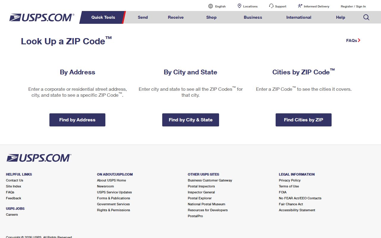
USPS ZIP Code Lookup offers By Address, By City and State, and Cities by ZIP tabs. By Address is the useful route for a house, unit, parcel-related mailing point, or organization. Enter the source address as written, then add the apartment or suite when several matches appear. USPS warns that its result does not confirm a person or company at that location.
| Field | Type | Requirement |
|---|---|---|
| Company | Text | Optional |
| Street Address | Text | Required |
| Apt/Suite | Text | Optional; helps narrow matches |
| City | Text | Required |
| State | Dropdown | Required |
| ZIP | Text | Optional in address mode |
The USPS ZIP Code Lookup pictured here is the official exact-address check.
Save the returned form beside the original wording instead of silently replacing historical or source text.
Find Bainbridge Island Residents by ZIP
A ZIP code narrows postal geography, but few official systems provide an unrestricted list of people by ZIP. The Assessor’s documented public help emphasizes site address, taxpayer name, and parcel account. VoteWA is a private identity login, not a public ZIP search. Voter-file access goes through county or state requests with field and purpose limits. The Department of Revenue unclaimed-property portal does accept ZIP, but it reports possible property connected to a name, not residence.
- Verify the full street, city, state, unit, and ZIP through USPS.
- Use the exact site address in Kitsap Parcel Details and keep site and mailing addresses separate.
- Browse City or Kitsap GIS for parcel and jurisdiction context when an address search fails.
- Use only a lawful Kitsap Elections or state extract request when statutory voter data is relevant.
- Move to the Bainbridge Island street directory after the ZIP narrows to a named road.
This sequence avoids claiming a public ZIP-wide resident roll that official sources do not offer. Each result should retain its date and recorded role.
Bainbridge Island ZIP Address Grid
Bainbridge Island’s official address application explains a local grid that can help resolve a puzzling number. Madison Avenue is the north-south baseline. Grid values rise east and west, house numbers add two digits to the grid, and consecutive numbers are about 22 feet apart. Odd numbers sit on south or west sides, while even numbers sit north or east. This explains local numbering, but USPS still controls postal validation.
Directionals matter. NE, NW, SE, SW, N, S, E, and W can distinguish roads or their old and new forms. Preserve the exact directional in the source. If a parcel search fails, try the house number and street name under the Assessor’s guidance, then restore the official directional and suffix from a verified result.
Kitsap Parcel Details gives three useful fallbacks when postal text is incomplete: taxpayer name, site address, and parcel or account number. The Assessor’s site-address instructions call for the house number and street name first, with the directional and suffix omitted in the initial entry where directed. Select the matching record, then compare the displayed site address with its mailing address. The two fields serve different purposes. A mailing address routes tax notices, while the site or situs address identifies the physical parcel. Neither field alone proves who occupies the place.
Address tip. Keep both the original and normalized Bainbridge Island form so a ZIP search never erases a useful historical label.
Bainbridge Island ZIP Name Changes
Kitsap DCD publishes an island road-name changes map that includes Fletcher Bay Road, High School Road, Day Road, Point White Drive, Fort Ward Hill Road, Miller Road, Madison Avenue, Sunrise Drive, Eagle Harbor Drive, Phelps Road, Crystal Springs Drive, Woods Road, Beach Drive, and Lynwood Center Road. Read the map directly. Similar-looking labels are not enough to declare an exact rename.
The DCD address-history report can bridge a previous address to a current one with a date, jurisdiction, and tax account. That link concerns the address record, not the identity of a resident. For vacant land, new work, or a failed street match, search the parcel or legal description and GIS instead of forcing the record into a postal directory.
| Input issue | Checked response |
|---|---|
| Missing directional | Search the parcel, then restore it from an official source. |
| Old road name | Search both forms and cite the DCD row. |
| Site and mailing differ | Store each in its stated role. |
| Winslow label | Keep both the historic label and current city context. |
| No street match | Use parcel, legal description, or GIS. |
Bainbridge Island ZIP Jurisdictions
The whole island’s municipal status changed in 1991, when island-wide annexation joined the area to the City of Winslow and led to the present City of Bainbridge Island. Older records may therefore name Kitsap County or Winslow where a current record uses Bainbridge Island. Historical community names can add another layer.
Keep a jurisdiction ladder for every address: USPS mailing city and ZIP, current municipality, county, tax parcel, service district, and historical community name. Water and sewer areas are irregular. Winslow Water serves Winslow and Fletcher Bay, while South Island sewer descriptions include Lynnwood Center, Point White, Pleasant Beach, Emerald Heights, Blakely School, and Rockaway Beach. A broad service map does not prove that one parcel is connected.
City and county GIS provide the geographic check. Their layers may show the municipal boundary, parcel geometry, zoning, land use, road ends, watershed, and water or sewer service areas. Map geometry is a research aid, not a land survey or title record. Follow a parcel account back to the Assessor for tax data and to the Auditor for recorded instruments. If the map, postal form, and parcel card disagree, retain all three source dates and ask the responsible agency which field it maintains.
Bainbridge Island Historical ZIP Research
USPS provides a historical post-office finder with From ZIP and To ZIP fields based on the first three digits. It warns that historical data may be outdated, so use the result as a lead. The PostalPro AIS Viewer offers Address Lookup, City/State Product, and ZIP+4 tools with monthly updates and no export. These tools solve postal questions, not personal identity.
Older Bainbridge Island research may use waterfront, port, landing, or community names because ferry and maritime life shaped the island. Winslow, Port Blakely, Port Madison, Island Center, Yeomalt, Eagledale, Creosote, Rolling Bay, and Seabold are useful search terms in maps, obituaries, directories, and archives. Label each as a historical or community term unless an official source defines a current boundary.
For a name that predates a modern street form, combine the historical label with the record keeper and year. Washington State Library directories, Kitsap Regional Library microfilm, Bainbridge History Museum holdings, and Puget Sound Regional Archives can preserve the older wording. The City’s historic-property guidance points to a 1909 owner map, selected 1929 Sanborn material, USGS maps from 1937 and 1953 onward, a 1940 county atlas, aerials from about 1951 forward, and older assessor records. Each source dates a different view. None should be recast as a present postal boundary.
Historical ZIP and post-office research also needs a clear cutoff. ZIP codes began after many island records were created, so an old directory or map may have no ZIP at all. Preserve its town, landing, road, or community label. Add a current 98110 form only as a separate modern reference after USPS and the parcel record confirm it. This keeps a useful archive term from being lost and prevents a modern code from being projected backward onto the source.
Bainbridge Island ZIP Versus City
No reviewed official source supplied complete 98110 boundary geometry, every neighborhood mapping, every postal alias, or a special PO-box-only or unique ZIP. The supported conclusion is narrow: 98110 is the only City ZIP identified in reviewed official sources, and USPS should verify each address. Do not draw a city boundary from a postal label or infer that a named person occupies a returned address.
- ZIP and ZIP+4
- A ZIP sorts a broader delivery area; ZIP+4 adds a smaller delivery segment.
- PO-box ZIP
- A ZIP assigned chiefly to post-office boxes. None was verified here.
- Unique ZIP
- A ZIP assigned to one high-volume organization. None was verified for Bainbridge Island.
- Carrier route
- A postal delivery path within a ZIP, not a city or parcel boundary.
A postal check can standardize and narrow a search. It cannot prove residence, ownership, municipal jurisdiction, or service connection. Pair postal data with the agency record built for the question.